")
")
")
")

Land-Use Mapping
 |
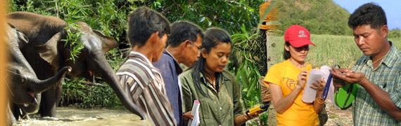
| An aerial photograph of land use around Salakpra, which is linked to GPS location data that allows us to match photographs to satelite maps. |
Land-use patterns in and around Salakpra have changed dramatically over the last 30 years (especially since the Srinakarin dam was built in 1980) as more and more people have settled the area. As well rainfall, temperature, and fire data, we need informative land-use maps of settled areas in and around Salakpra in order to understand what factors are, and are not, linked to crop-raiding, so that we can identify the most effective HEC mitigation measures, including a sustainable system of forest use and protection with villagers helping protected area personnel. To date, ECN has mapped land use in the most intensive crop-raiding areas using aerial photographs linked to GPS point data. In time we aim to map every sub-district around Salakpra, and to monitor seasonal changes in land use so we can compare this data with crop-raiding data.